Regional workshop on carbon emission estimation underway

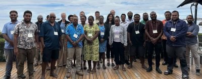
Workshop participants.
A regional workshop on land cover mapping to estimate carbon emissions in Pacific Island countries is currently underway in Honiara, Solomon Islands.
The workshop aims to present an open-source algorithm to map the six International Panel on Climate Change (IPCC) land use categories over time (including mapping changes between categories), to provide training on two widely used cloud-computing platforms namely google earth engine and SEPAL, and further to explore methods of
dividing the forest land class into subcategories.
Under USAID, SilvaCarbon partners with USGS, GIZ, FAO and Solomon Islands Government through the Ministry of Forestry and Research to progress this program in Solomon Islands.
SilvaCarbon is an interagency technical cooperation program of the US Government to enhance the capacity of selected tropical countries to measure, monitor, and report on carbon in their forests and other lands.
Solomon Islands Forestry Permanent Secretary, Dr. Vaeno Wayne Vigulu in opening the workshop acknowledges the efforts undertaken by the respective donor organizations towards a collective strive, to making sure technical capacity of pacific islands expertise on estimating carbon emissions are up to international standard.
Particularly noting SilvaCarbon program expertise for availing themselves to collaborate and share technical information’s.
“SilvaCarbon is a strategic program of the U.S. government that provides technical assistance for countries that have joined the REDD+ initiative and report on emissions
from forest-related activities.
“Solomon Islands is one of the countries and therefore under the REDD+ Framework we look forward to partner with SilvaCarbon on the subject matter.”
He adds one interesting aspect to this workshop, will be the presentation of SilvaCarbon team on how to use sample methods to create unbiased map areas and confidence
intervals, including how to integrate these map areas into the emissions estimation process.
“This is timely and will add on the knowledge developed on the subject matter.”
The Forestry Permanent Secretary went on further to thank SilvaCarbon program for its ongoing collaboration and sharing of information with the provision of the much needed support to the Solomon Islands in their effort to map land use for REDD+ and other resource management purposes.
“I would like to acknowledge SilvaCarbon on behalf of the Solomon Islands Government for the ongoing support and still looking forward to collaborate and partnering in the REDD+ implementation going forward.
“Especially on capacity building on Land Cover/ Forest cover mapping for the Solomon Islands Forests, as more land use changes are anticipated due to the changing needs and increasing dynamic population across our nation.”
Dr Vigulu also stresses that monitoring land use change represents a critical component in the process of estimating carbon emissions from the land sector.
“And with the International Panel on Climate Change (IPCC) support in providing technical guidance on which land use categories to map and on how to use these categories to calculate emissions has been indeed helpful.
“Thus, we are looking forward on the similar assistance on the IPCC technical guidance to map the dynamic landscape changes and the categories that applies to calculate
emissions on the anticipated various land use progressive changes.”
He then urges all visiting participants from other Pacific Island countries and in country participants to make good use of this unique opportunity and grasp the required
technical knowledge in this workshop.
“This workshop will touch on very interesting topics and areas that may be new to some of us or familiar but have yet to discover the techniques to go around the
emerging issue and developing commodity, the Carbon, as a nontimber forest product under REDD+.”
The workshop starts on August 7th – 11th August 2023 is held at the Heritage Park Hotel.
ENDS//
– MoFR Press
